The weather service has warned of disruptive rain, which may lead to flooding in at least three provinces.
Gallo Images/Sowetan/Sandile Ndlovu
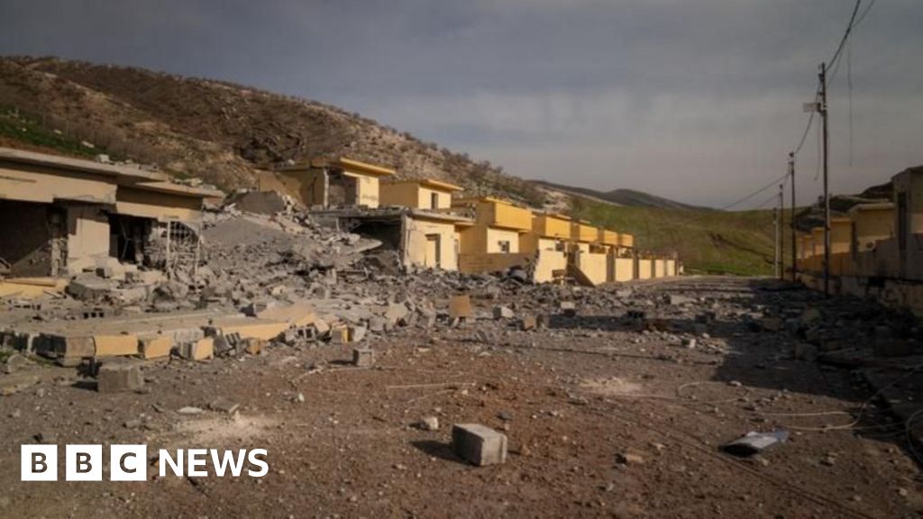
The South African Weather Service (SAWS) has issued warnings of disruptive rain, which may lead to flooding in parts of Limpopo, Mpumalanga, and KwaZulu-Natal, where severe thunderstorms are also expected.
Impact-based warnings
An Orange Level 9 warning for disruptive rainfall resulting in widespread flooding of roads and settlements, widespread mudslides, rockfalls and soil erosion, and danger to life due to fast-flowing streams is expected over the eastern parts of Limpopo (Vhembe and Mopani District Municipalities) and over Mpumalanga Lowveld and escarpment (Ehlanzeni District Municipality). SAWS also warns of potential widespread damage to property, buildings and loss of livelihoods and livestock, as well as possible widespread displacement of affected communities.
An Orange Level 6 warning for disruptive rainfall resulting in flooding of roads and settlements (formal and informal), mudslides rockfalls and soil erosion, danger to life due to fast-flowing streams, damage to property, infrastructure, loss of livelihood and livestock are expected over the central parts of Limpopo (parts of Capricorn and Sekhukhune District Municipalities) and eastern Highveld of Mpumalanga (Emakhazeni, Msukaligwa, Mkhondo and Chief Albert Luthuli Local Municipalities).
A Yellow Level 4 warning for disruptive rain with heavy downpours leading to flooding of roads and settlements, displacement of affected communities, and disruption of traffic flow due to major roads being flooded or closed is expected over the north-eastern parts of KwaZulu-Natal.
A Yellow Level 2 warning for disruptive rainfall resulting in localised flooding of susceptible formal/informal settlements or roads, low-lying areas and bridges, localised mudslides, rockfalls and soil erosion is expected in places over the central parts of Mpumalanga and western parts of Limpopo, excluding the extreme south-western parts.
Yellow Level 2 warning: Severe thunderstorms with heavy downpours, damaging winds, large amounts of hail and excessive lighting are expected over the western parts of KwaZulu-Natal, leading to localised flooding and damage to settlements and infrastructure.
In the SAWS’ colour-coded weather warning system, yellow indicates a moderate risk of impact that requires caution and awareness, while orange indicates that a higher-risk impact is expected, requiring increased attention and preparation.
SAWS uses the numbers to indicate the likelihood of weather-based impacts occurring. Levels 2 and 6 are high, and Level 4 is low.
The weather in your province
Gauteng: Cloudy and warm with isolated showers and thundershowers.
Pretoria: 16°C — 30°C
Johannesburg: 14°C — 27°C
Vereeniging: 15°C — 29°C
Mpumalanga: Morning fog patches along the escarpment, otherwise cloudy and cool to warm. Expect isolated to scattered showers and thundershowers, with widespread rain in the east.
Limpopo: Cloudy and cool to warm with isolated to scattered showers and thundershowers, widespread in the east.
North West: Partly cloudy and hot with isolated afternoon thundershowers.
Mahikeng: 17°C — 32°C
Vryburg: 21°C — 34°C
Free State: Partly cloudy and hot with isolated afternoon thundershowers.
Bloemfontein: 20°C — 35°C
Northern Cape: Fine in central parts, partly cloudy and cool to warm elsewhere, but hot in the north-east. Isolated thundershowers are expected in the extreme east.
Coastal winds: Fresh to strong southerly to south-easterly.
Kimberley: 18°C — 34°C
Upington: 17°C — 36°C
Western Cape: Cloudy along the south coast and adjacent interior, partly cloudy and cool to warm elsewhere. Isolated showers and rain in the west and south, scattered along the south coast.
Coastal winds: Moderate to fresh southerly to south-easterly, strong along the west and south-west coast.
Cape Town: 16°C — 23°C
George: 16°C — 21°C
Western half of the Eastern Cape: Cloudy and cool to warm with isolated showers and rain, scattered along the coast.
Coastal winds: Fresh to strong southerly to south-easterly.
Eastern half of the Eastern Cape: Cloudy and cool to warm with scattered showers and thundershowers.
Coastal winds: Fresh to strong south-westerly, becoming southerly to south-easterly south of Kei Mouth in the afternoon.
Gqeberha: 19°C — 26°C
East London: 19°C — 26°C
KwaZulu-Natal: Morning fog patches over the southern and western interior, partly cloudy to cloudy and warm. Scattered showers and thundershowers are expected, widespread in the north-east.
Coastal winds: Moderate to fresh northerly to north-easterly, becoming light to moderate southerly to south-westerly in the south from late morning, spreading northwards and reaching fresh in places.
Durban: 23°C — 28°C
Richards Bay: 24°C — 32°C
Pietermaritzburg: 19°C — 27°C
*This weather report was written with the support of Toqan AI.