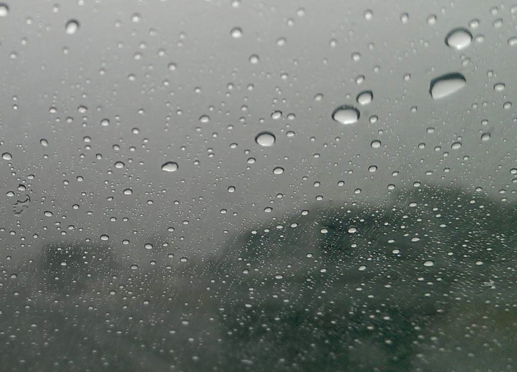
Severe thunderstorms and heavy rains are expected.
PHOTO: Duncan Alfreds, News24
Residents in parts of the North West, Eastern Cape and the Free State have been warned by the South African Weather Service to brace for severe thunderstorms and disruptive rain.
Impact-based warnings:
A. A yellow level 2 warning has been issued for disruptive rain that could lead to localised flooding of susceptible settlements, roads, low-lying areas and bridges along the coast between Port Alfred and Port Edward in the Eastern Cape.
B. A yellow level 2 warning for severe thunderstorms with possible strong damaging winds and large amounts of small hail are expected over the eastern parts of Free State and the central and south-eastern parts of the North West.
Fire danger warning:
Extremely high fire danger conditions are expected over the north-eastern parts of the Northern Cape as well as the western parts of both the North West and the Free State.
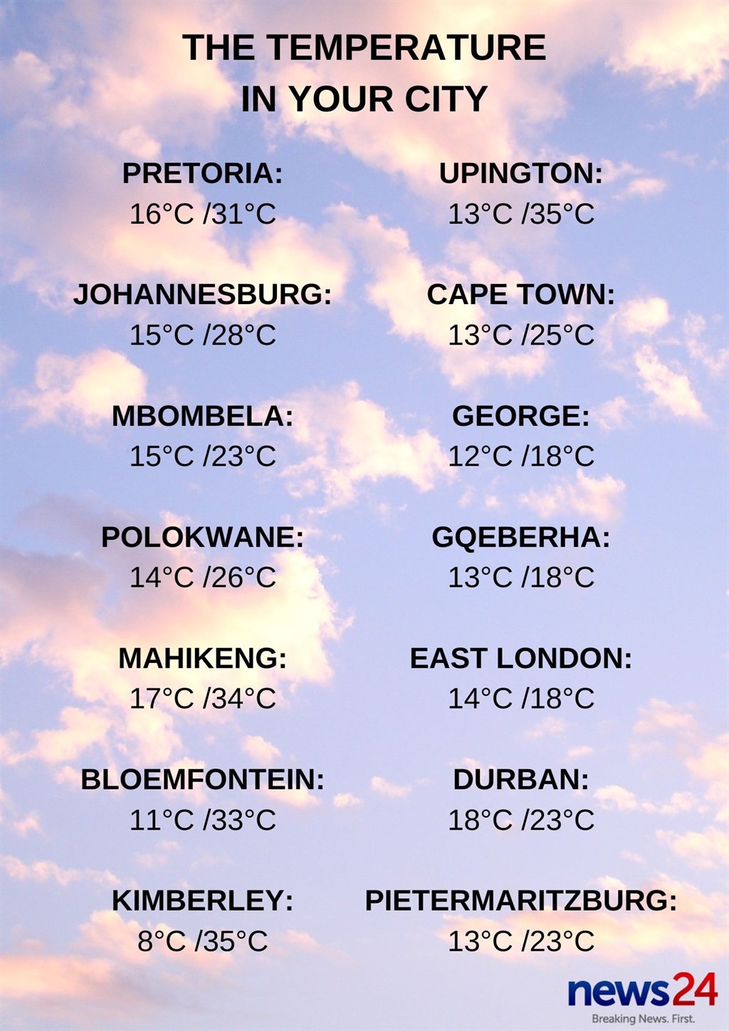
The weather in your province:
Gauteng will be partly cloudy and warm, becoming cloudy with isolated late afternoon showers and thundershowers, but scattered in the extreme south.
The expected UVB sunburn index is high.
It will be partly cloudy and warm in Mpumalanga, becoming cloudy with isolated showers and thundershowers on the highveld in the evening, but scattered in the extreme south-west.
Limpopo will be cloudy in the north and east with drizzle and fog patches, becoming partly cloudy and warm to hot in the north.
The North West is expected to be partly cloudy, windy and hot with isolated to scattered thundershowers, except in the south-western part.
It will be partly cloudy and warm to hot in the Free State, with isolated to scattered thundershowers in the east.
The Northern Cape can expect conditions to be fine and cool to warm, but hot in the east. It will become partly cloudy in the north-east by the afternoon. The wind along the coast will be light to moderate southerly to south-westerly.
Fog patches are expected in the morning in the south-eastern parts of the Western Cape, otherwise partly cloudy and warm, but fine in the west. It will be cool in places along the south coast. The wind along the coast will be fresh to strong easterly to south-easterly, otherwise light and variable north of Table Bay.
The expected UVB sunburn index is very high.
The western half of the Eastern Cape will be cold in places, otherwise cloudy and cool with light rain south of the escarpment. Scattered light showers and rain are expected along the coast and adjacent interior east of Oyster Bay.
The wind along the coast will be light to moderate north-easterly, reaching fresh to strong in places from the afternoon.
The eastern half of the province can expect partly cloudy and cool to warm conditions with isolated thundershowers in the north-east. Otherwise, it will be cloudy and cold with scattered showers and rain, but widespread along the coast.
The wind along the coast will be light to moderate easterly, becoming fresh to strong north-easterly from the afternoon.
Morning fog has been forecast over the interior of KwaZulu-Natal, otherwise partly cloudy and cool, but warm in the north with isolated showers and thundershowers but scattered in the south-east.
The wind along the coast will be moderate north-easterly.
The expected UVB sunburn index is high.