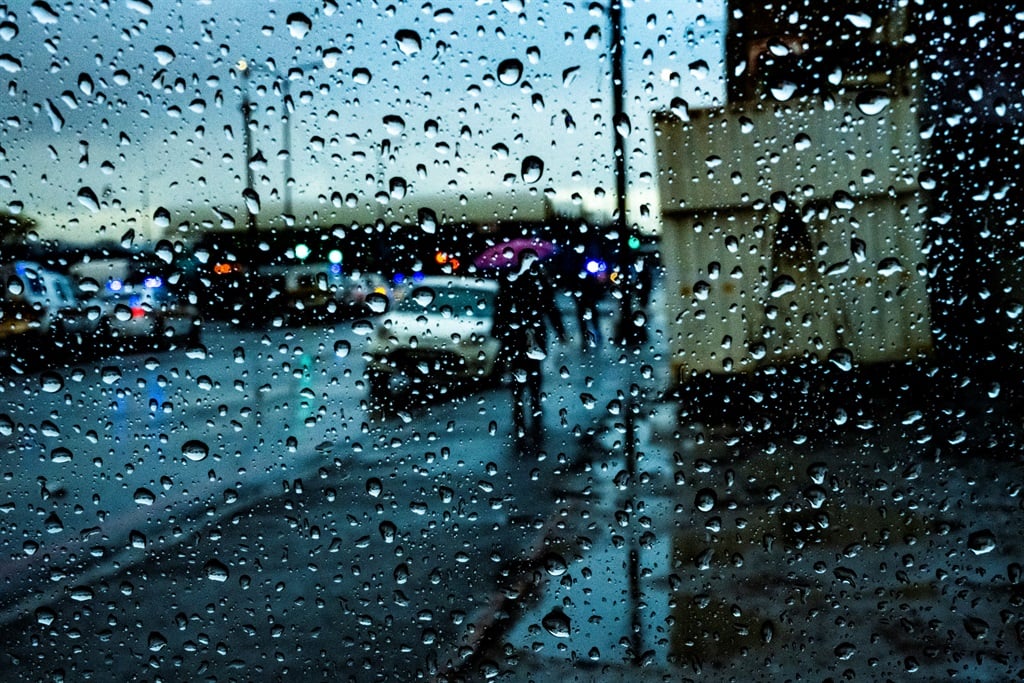
Disruptive rainfall expected in at least two provinces. (Jaco Marais/Gallo Images/Die Burger)
There's a storm brewing in KwaZulu-Natal and Mpumalanga, with the South African Weather Service issuing Orange Level 6, Yellow Level 2, and Yellow Level 4 warnings for disruptive rain leading to flooding of roads and settlements, difficulty driving on dirt roads, and damage to infrastructure and mud-based houses.
READ | KZN warned to brace for heavy rain, flooding after warning issued
Impact-based warnings
A Yellow Level 4 warning for damaging winds and waves has been issued between Richards Bay and Kosi Bay.
Fire danger warnings
Extremely high fire danger conditions are expected in the Walter Sisulu Local Municipality in Eastern Cape, as well as parts of the Northern Cape, North West, Free State and Limpopo.
Advisories
Extremely hot and humid conditions are expected in the northern parts and Lowveld of Limpopo.
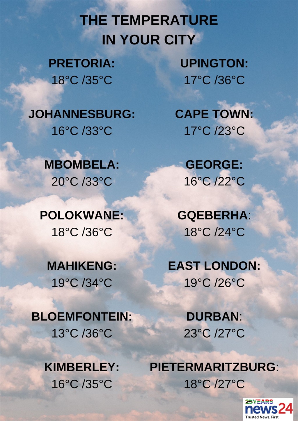
The weather in your region
Partly cloudy and hot conditions are expected in Gauteng.
The expected UVB sunburn index is high.
Mpumalanga will be cloudy with warm to hot temperatures and isolated to scattered showers and thundershowers in the east, but widespread in the extreme south-east. Otherwise, it will be partly cloudy.
Partly cloudy and hot to very hot conditions are forecast in Limpopo, with isolated to scattered showers and thundershowers in the east.
The North West can expect partly cloudy and hot to very hot temperatures with isolated thundershowers, except in the east.
Partly cloudy and hot conditions are forecast in the Free State with isolated afternoon thundershowers.
The Northern Cape will be fine with hot to very hot temperatures, but partly cloudy in the north-eastern parts with isolated thundershowers.
The wind along the coast will be a moderate to fresh south to south-easterly.
Cloudy and cool conditions are expected in the Western Cape, with rain along the south coast and the adjacent interior. Otherwise, it will be partly cloudy and warm.
The wind along the coast will be a light to moderate south-westerly to westerly along the south coast. Otherwise, a moderate to fresh southerly is expected.
The expected UVB sunburn index is extreme.
Weather for tomorrow, 13-03-2024. Partly cloudy and warm to hot, with isolated showers and thundershowers over the central and eastern parts, but widespread to scattered rain & showers are expected in the the eastern parts of Mpumalanga & KZN.
Warning: Disruptive rain. #saws pic.twitter.com/AIl6aMwusQ
Partly cloudy conditions are expected in the western half of the Eastern Cape, with isolated thunderstorms in parts of the north.
Otherwise, it will be cloudy with cool to warm temperatures and isolated showers and rain.
The wind along the coast will be a light westerly in the early morning. Otherwise, a moderate to fresh south-westerly is forecast.
The eastern half of the province will have morning fog in places over the interior. Otherwise, cloudy and cool to warm conditions with isolated showers and thundershowers are forecast, but scattered south of the escarpment.
The wind along the coast will be a light to moderate south-westerly, becoming moderate to fresh south-easterly in the afternoon.
KwaZulu-Natal can expect partly cloudy conditions in the west, with morning fog in places over the interior. Otherwise, cloudy and warm to hot temperatures are forecast in places in the north with isolated showers and thundershowers, but scattered to widespread in the north-east.
The wind along the coast will be a strong to gale force southerly to south-easterly, reaching strong gale force in the extreme north.
Otherwise, a fresh to strong southerly to south-westerly is forecast.
The expected UVB sunburn index is very high.